A perfect walk to Càrn a’Mhaim

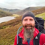
Sometimes, without any discernible reason, a day in the hills can take on almost magical properties. The sounds, smells, views, and general atmosphere adds up into one giant ball of delight. My last trip into the Cairngorms was a day just like this.
The day hadn’t started so well, however. I was up in Aberdeen, so I had an hour less driving to my start point at the Linn of Dee. The other drivers on the north Deeside road were more interested in a very leisurely, midweek drive. Thus, I found myself pulling into my start point around 10 am, an hour later than I wanted to hit the trail. An hour late on a day where I would be racking up 14 to 16 miles. At least the car park was quiet. I quickly threw my boots on and set off down the track.

I’m pretty confident that I could walk the route from the Linn of Dee to Derry Lodge with my eyes closed. It’s some 30+ years since I first walked that path. I have clear memories as a pre-teen walking down the landrover track on a clear night, our way beautifully lit by the full moon. I have other memories of seeing large herds of deer gathered on the opposite side of the Lui Water, grazing in the shadows of Sgòr Dubh. Most of the deer are long since gone, culled to a more sustainable level. Sgòr Dubh, on the other hand, remains. The textures on its slopes were looking wonderful on this particular day.
It takes almost exactly one hour for me to walk the three miles to the boarded-up hunting lodge of Derry Lodge. From there, the onwards route west leads through an area of ancient Caledonian forest which is slowly regenerating naturally. The forest has been able to do so since the deer were returned to more natural numbers. Previously, the slightest hint of a Scots Pine sapling would have been eaten before it had a chance to establish and grow into a magnificent, mature tree. An hour of walking through the recovering forest, and a quick fording of the Luibeg Burn, saw me at the foot of the steep pull up Càrn a’Mhaim itself.

There is a good path leading to the summit of Càrn a’Mhaim, climbing from the right of the main track. The lower path winds around into the Lairig Ghru. I could also see the high-vis jacket of a path maintenance worker much higher up, suggesting work is not yet complete on this route. As I climbed, the wind gained strength. I soon dug out my waterproof jacket for its windproof properties and continued for the top, reaching it not long after.
From the summit, I had spectacular views across the Lairig Ghru to Beinn Bhrotain and The Devil’s Point (Bod an Deamhain). Clouds were pouring over the higher peaks of Cairn Toul, Sgor an Lochain Uaine, and Braeriach. Ben Macdui, Scotland’s second-highest mountain, had its summit firmly planted in the clouds. In total contrast to the walk up, there was not a breath of wind where I sat. This allowed me to linger on the top for a good while, enjoying lunch. The magical views of all these hills provided a splendid backdrop. As I’ve mentioned before, these hills are my most favourite place in the world to be.

Walkhighlands suggests returning from Càrn a’Mhaim by simply retracing your route there. I’m not a fan of going out and back the same way — a circular route feels more like a journey. Plus, the ridge leading North-Northwest with its rocky outcrops and steep slopes on both sides is not to be missed. I followed this to the bealach before Ben Macdui, turned sharply to the Southeast and picked a pathless way down the side of the Allt Carn a’ Mhaim. While following this stream back down towards Luibeg Bridge, I was gifted my final treat of the day. A sole stag was walking high up on the eastern flank of Càrn a’Mhaim. He was calling out lonesomely. Almost like he could remember the large herds from my childhood.